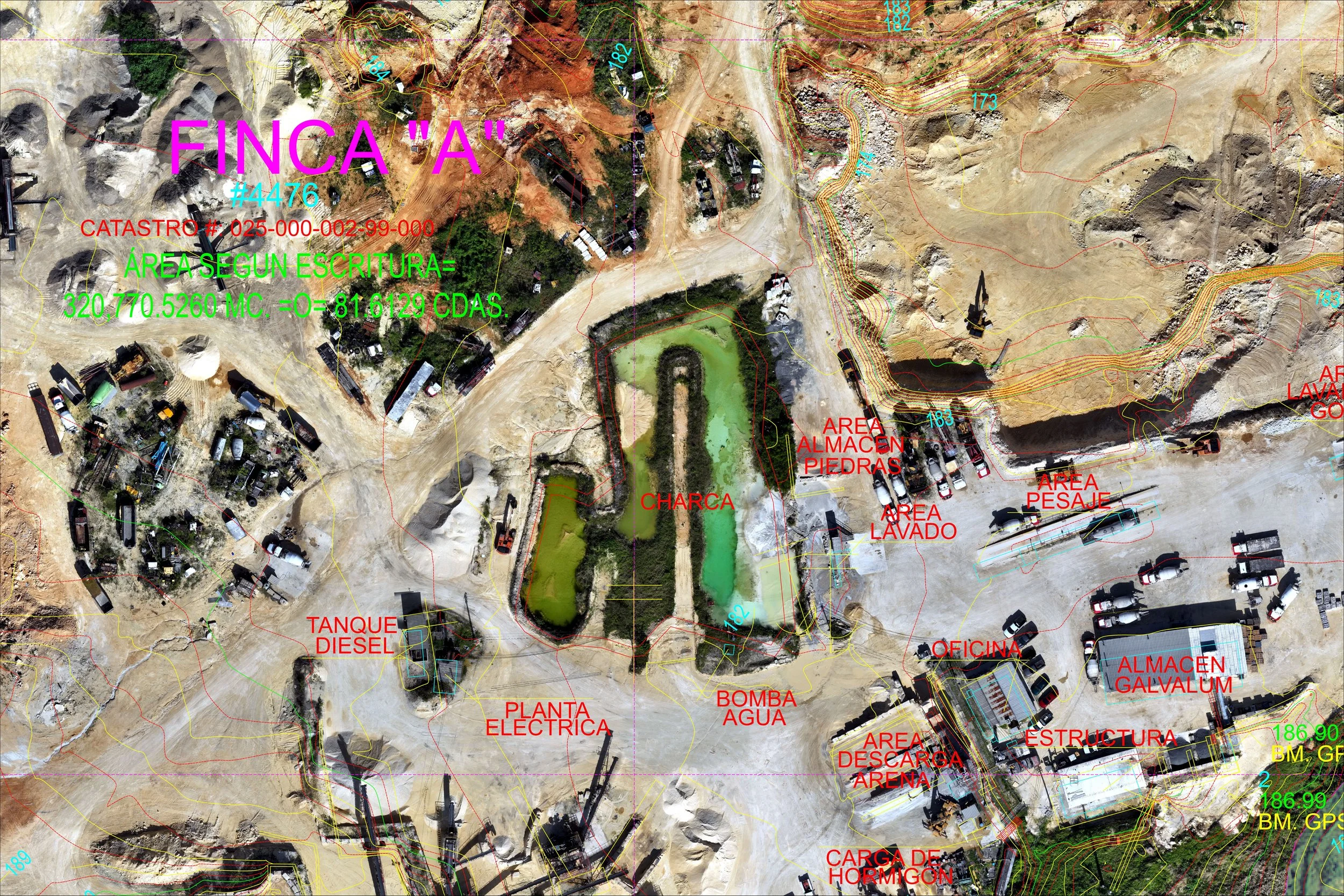
DEVELOPMENT OF GEOREFERENCED ORTHOMOSAIC FOR AGGREGATES QUARRY IN ISABELA, PR
The project involved a comprehensive mission planning phase as well as the acquisition of photographic data using a high-resolution payload. This was essential for the development of an accurate quarry model, which plays a crucial role in understanding the site's geological features and potential resources. Additionally, the project focused on creating a high-resolution orthomosaic that is georeferenced to the PRVI NAD83 (2011) coordinate system. This georeferencing is vital for ensuring precise location data, which facilitates effective comparisons of the site footprint. Such comparisons are particularly important for planning material extraction, as they allow for a detailed analysis of the area to optimize resource utilization and minimize environmental impact. Overall, the integration of advanced imaging technology and geospatial analysis in this project aims to enhance the efficiency and effectiveness of quarry operations.


